Copper Creek Hut is closed during the summer season.
Maps: An updated map with detailed information about the trail system was published in 2019 and copies of the map can be obtained from Whittaker Mountaineering in Ashford. If you have a copy of the map published in 2001, please keep in mind that some of the ski trails and sno-park access locations shown on it are no longer in use.
The Washington State Department of Natural Resources published a recreation map for Elbe Hills and Tahoma State Forests in 2015 that includes the MTTA trail system as currently in use. The map is available as a free download in pdf format here.
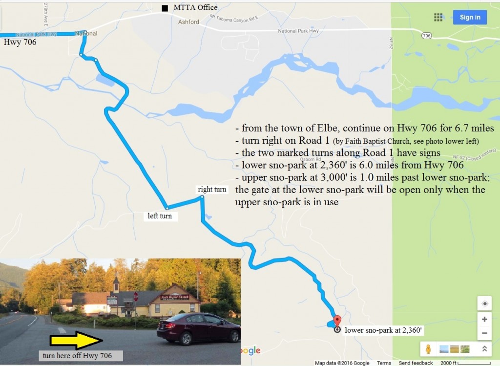
Directions to South District/High Hut, Snow Bowl Hut, Yurt: We use two sno-parks in our South District, a lower sno-park located at an elevation of 2,360′ and an upper sno-park at an elevation of 3,000′. Typically the lower sno-park is in use; we use the upper sno-park when the snow level is at or above 3,000′. A map with directions to our South District sno-parks can be viewed here.
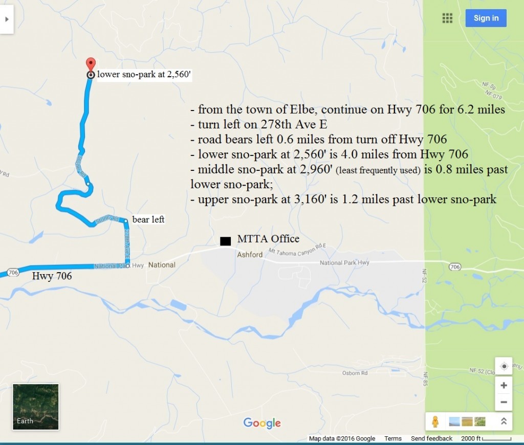
Directions to North District/Copper Creek Hut: We have three sno-parks available for use in our North District, a lower sno-park located at an elevation of 2,560′, a middle sno-park at an elevation of 2,960′ (least frequently used) and an upper sno-park at an elevation of 3,160′. The lower or upper sno-parks are most often in use depending on the snow level. A map with directions to our North District sno-parks can be viewed here.